USS Elmore


Ulithi – Top Secret: The US Naval Base at Ulithi Atoll Was Once the World’s Largest Naval Facility
On 22 September 1944, a regimental combat team from the Army’s 81st Infantry Division took a giant step on the road toward the Japanese homeland, at no cost whatsoever. The soldiers went ashore at Ulithi atoll. Through his constant study of maps, Admiral Nimitz discovered this atoll and readily saw its value. He called it the U.S. Navy’s secret weapon, and his censors made sure that no reporter made mention of it. But the Japanese knew Ulithi was there, as it was only 90 miles distant from Japan's base on the nearby island of Yap, which the American had bypassed.
Ulithi Satellite View
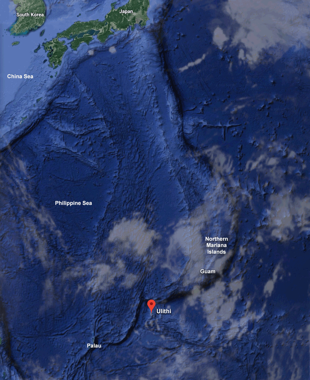
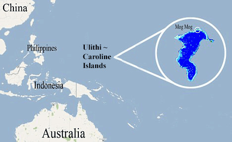
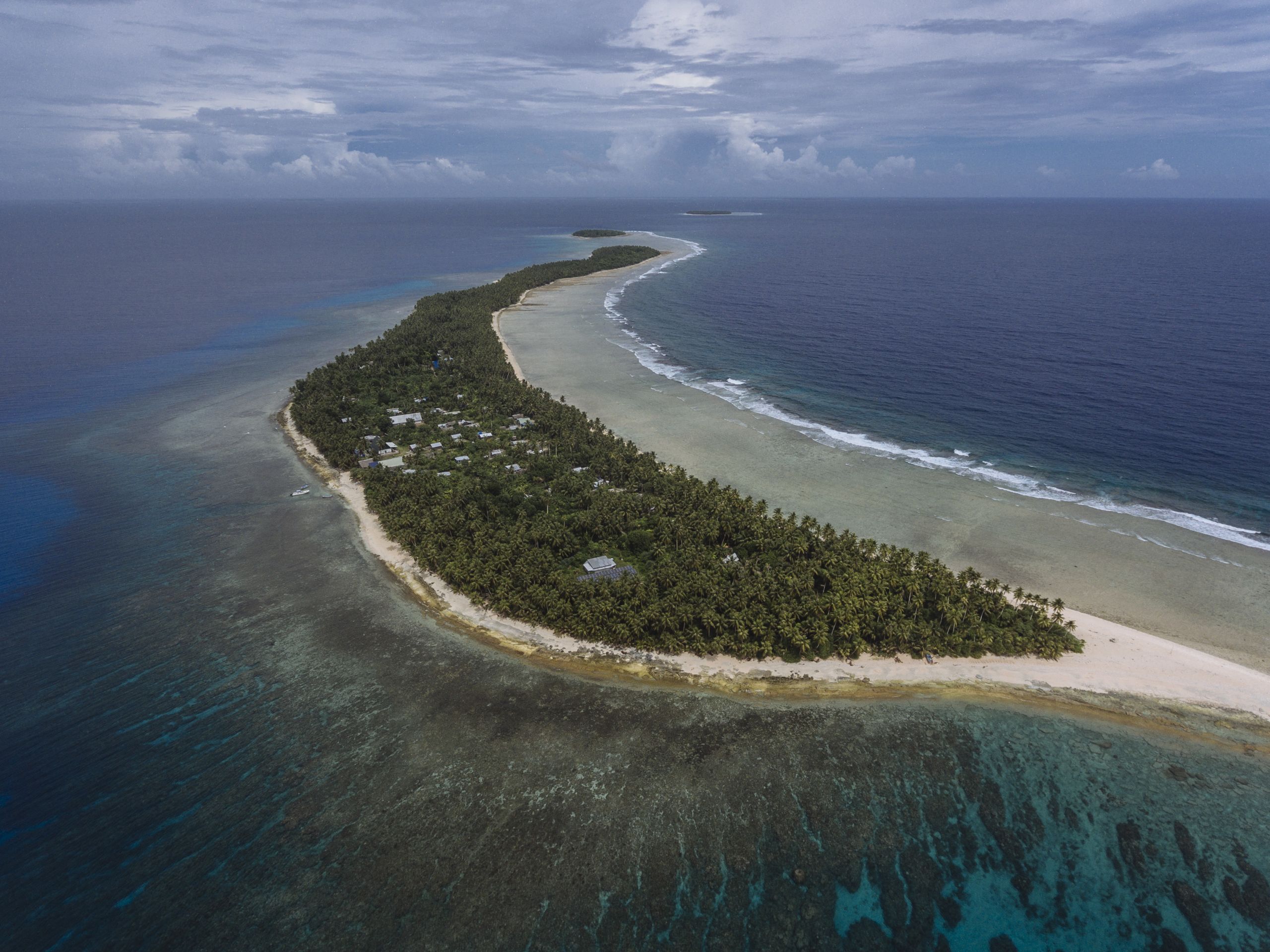
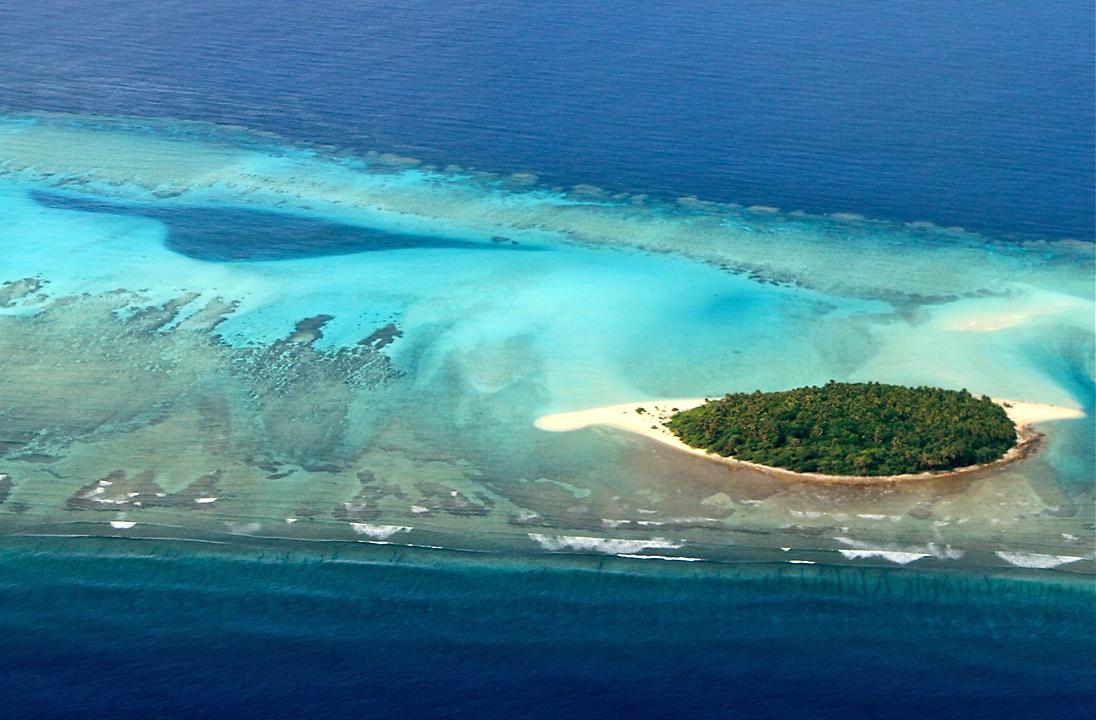
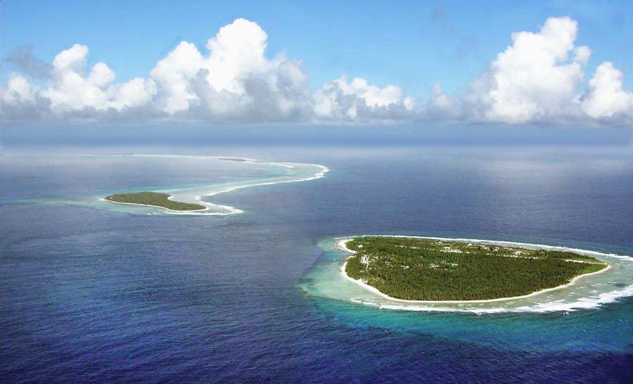
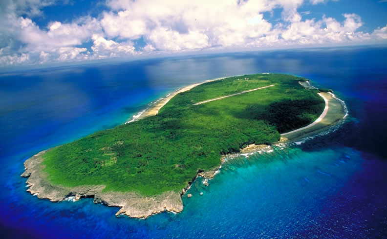
Ulithi, located in the West Caroline Islands, is 1,300 miles south of Japan, specifically Tokyo, 850 miles east of the Philippines, and 360 miles southwest of Guam. It is a classic Pacific atoll with coral reef, palm trees, and white sand. It had depths ranging 80 to 100 feet; suitable depths for anchoring the huge naval ships. It was the only fitting haven for 800 miles where the US Navy could anchor its ships. The coral reef is approximately 20 miles long and 10 miles wide, and there are over 30 little islands rising slightly above sea level, the largest only half a square mile in area.
When the US Navy landed in Ulithi in September, 1944, it found 400 natives and three enemy soldiers residing there. The natives, who were settled on four larger islands, Sorlen, Falalop, Asor, and Mogmog, were all moved to a smaller island, Fassarai.
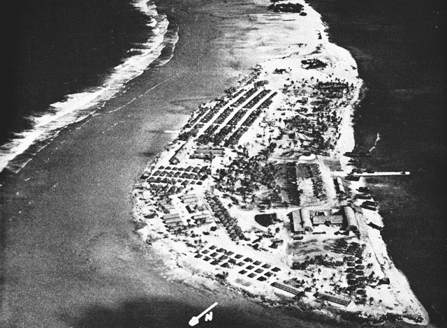
A 3,500-foot airstrip was built at Falalop; it was just barely wide enough to handle Douglas C-47 Skytrains and the R5C (C46) Commandos that would arrive from Guam. On a weekly basis, 4,565 sacks of mail, 262,251 pounds of air freight, and 1,269 passengers would land on this airstrip.
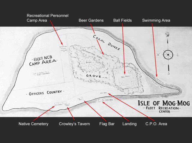
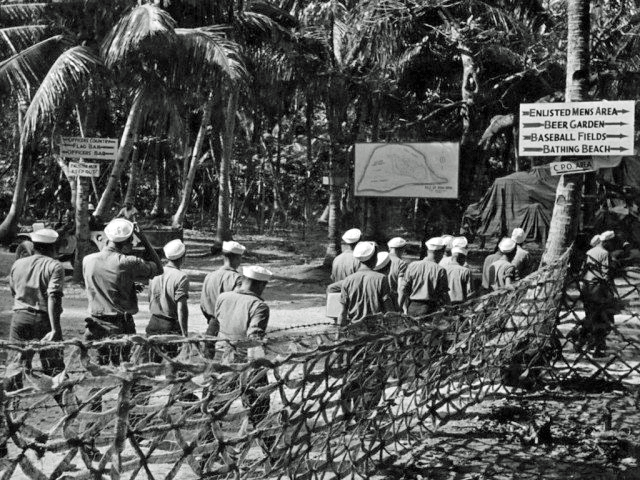
Mogmog was the location for recreation. Through sheer ingenuity, the Seabees shoehorned the facilities of an entire naval base onto the remaining tiny strips of land that comprise Ulithi atoll.
Commodore Worrall R. Carter created the phenomenal mobile service command that allowed the US Navy to head for Japan in great strides. Instead of utilizing the costly and time-consuming alternative of seizing hundreds of small islands on which to build a series of land bases and airstrips, Commodore Carter created a mobile replenishment system.
Many refrigerated and food supply ships operated by a three-tier team:
Ship # 1 docked at Ulithi and was emptied of its supplies and then headed out to relieve
Ship # 2 which was at the rear dock being loaded with more supplies, while
Ship # 3 was on the way to Ulithi to relieve Ship # 1.
More than half the ships had to be towed to actually dock. Some of them remained docked to serve as inventory warehouses as the recurring system of load, unload, and distribute provided food and stores for the base and personnel.
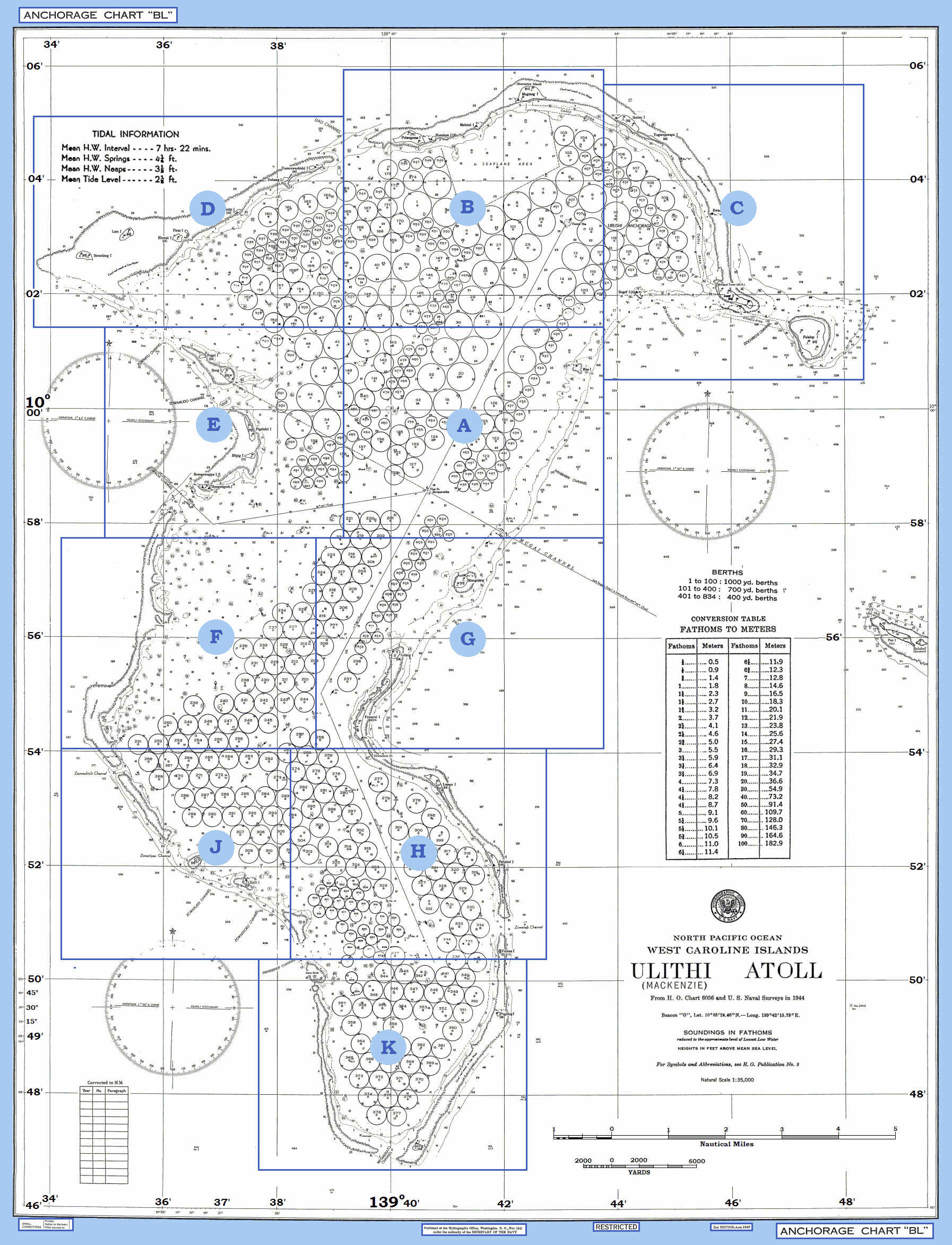
MAP ON RIGHT. This is a 1944 survey map that shows the ship berthing positions within Ulithi Atoll. Area "A" is also where USS Mississinewa (AO-59) was sunk by Japanese kaiten manned torpedoes launched from two nearby submarines. Click on map (at right) to zoom.
Sorlen Island in Ulithi Atoll featured a 1,600-seat movie theater and a hospital. Water was pumped in from the ocean and distilled on site.
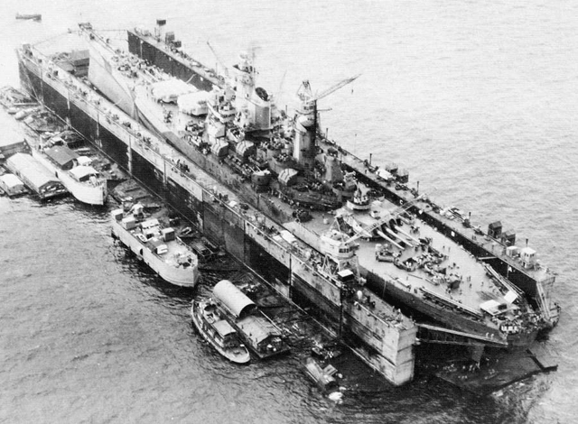
The Navy set up floating dry docks to maintain and repair ships at the atoll. USS Iowa (BB-61), undergoing repairs in 1945.
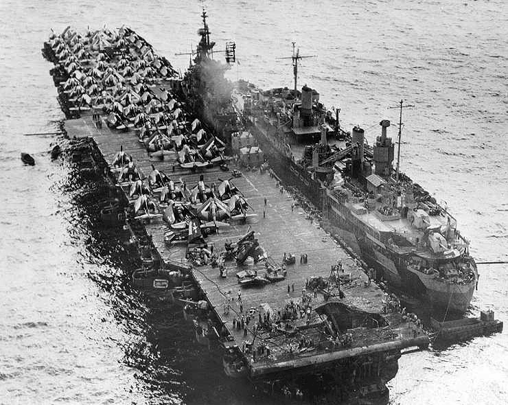
The U.S. Navy aircraft carrier USS Randolph (CV-15) alongside repair ship USS Jason (ARH-1) at Ulithi Atoll, Caroline Islands, 13 March 1945, showing damage to her aft flight deck resulting from a kamikaze hit on 11 March. The photograph was taken from a floatplane from the light cruiser USS Miami (CL-89).
Ulithi Atol served primarily as a mammoth anchoring and refueling point for Navy ships. American forces landed there in September 1944 and began building one of the largest naval bases used during the war. At it's peak, Ulithi Atoll housed 617 ships, had its own 1,200-yard airstrip, and hosted 20,000 troops on its recreation island, Mogmog.
In addition to ship repair, military supply, and safe anchorage, Ulithi housed the tankers that were used to quench the U.S. Pacific Fleet’s enormous thirst for fuel oil. An estimated monthly consumption of over 6 million barrels had to be met by commercial tankers bringing oil from the West Coast to Ulithi. There, a floating storage of more than 100,000 barrels were always maintained. A shuttle service of forty tankers operated between Ulithi and the U.S. Fleet in the western Pacific. In addition, 900,000 barrels of reserve fuel was divided among Saipan, Guam, and Kwajalein, plus a 5 million barrel reserve was held at Pearl Harbor.
Fleet oilers sortied from Ulithi to meet the task forces at sea, refueling the warships a short distance from their combat operational areas. The result was something never seen before: a vast floating service station enabling the entire Pacific fleet to operate indefinitely at unprecedented distances from its mainland bases. Ulithi was as far away from the US Naval base at San Francisco as San Francisco was from London, England. The Japanese had considered that the vastness of the Pacific Ocean would make it very difficult for the US to sustain operations in the western Pacific. With the Ulithi naval base to refit, repair and resupply, many ships were able to deploy and operate in the western Pacific for a year or more without returning to the Naval base at Pearl Harbor.
The Japanese had built an airstrip on Falalop. It was expanded and resurfaced, the runway running the full width of the island. The east end of the strip was extended approximately twenty feet (6.1 metres) past the natural shoreline. A number of small strips for light aircraft were built on several of the smaller islands. The Seabees completed a fleet recreation center at Mog Mog island that could accommodate 8,000 men and 1,000 officers daily. A 1,200-seat theatre, including a 25-by-40-foot (8 by 12 m) stage with a Quonset hut roof was completed in 20 days. At the same time, a 500-seat chapel was built. A number of the larger islands were used both as bases to support naval vessels and facilities within the lagoon.
Within a month of its occupation, a whole floating base operated at Ulithi. Six thousand ship fitters, artificers, welders, carpenters and electricians arrived aboard repair ships, destroyer tenders, and floating dry docks. The USS Ajax had an air-conditioned optical shop, a supply of base metals from which she could make any alloy. Many refrigerator and merchant ships combined to form revolving supply teams. It has been estimated that over half of the ships were not self-propelled but were towed in. They then served as warehouses for a whole system of transports, which unloaded stores for distribution. This kind of chain went all the way back to the United States.
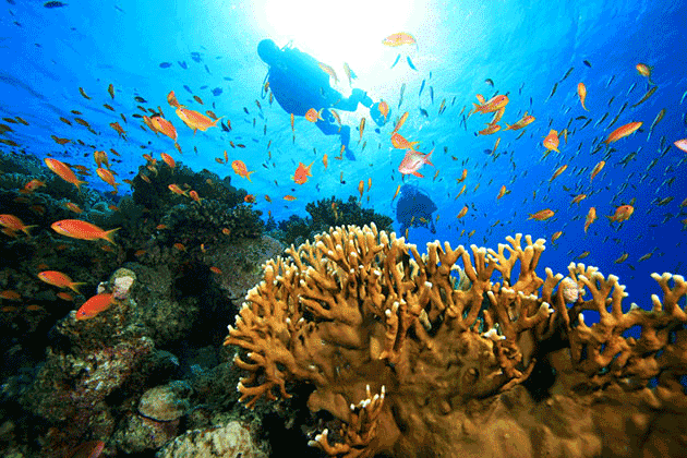
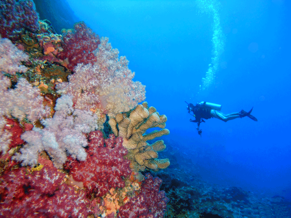
By 13 March 1945, there were 647 ships at anchor at Ulithi, and with the arrival of amphibious forces staging for the invasion of Okinawa, the number of ships at anchor peaked at 722. At its height, Ulithi had a temporary population of a large US city and was the ruler of the Pacific. After Leyte Gulf in the Philippines was secured, the Pacific Fleet moved its forward staging area to Leyte, and Ulithi was was reduced to little more than a tanker depot. In the end, few US civilians ever heard of Ulithi. By the time Naval security cleared release of the name, there were no longer reasons to print stories about it. The war had moved on, but for seven months in late 1944 and early 1945, the large lagoon of the Ulithi atoll was the largest and most active anchorage in the world. Inevitably, just as it had been before the war, Ulithi became a lonely, quiet coral island. Today, it has become a diver's tropical paradise.
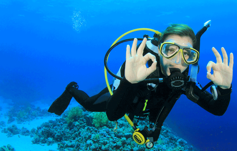
Scuba Diving: Ulithi and Yap
March 2001
By Nick Lucey
Photography by Tim Rock
Tucked away in one of the deepest, darkest corners of military history is Ulithi Atoll, a staging area for the U.S. Navy during World War II. Overshadowed by other Micronesian islands such as Peleliu, Kwajalein and Tarawa, Ulithi was for seven months the world's largest naval facility, a stepping stone in the United States' island-hopping campaign across the Pacific.
The Navy's Secret Weapon
Halfway between Guam and Palau, about 100 miles northeast of Yap's main island lies Ulithi Atoll and its massive lagoon, the world's fourth largest. The atoll is volcanic in origin, with white-sand beaches, beautiful fringing reefs and swaying palm trees. About three dozen small islets--the biggest no more than half a square mile in area--have a combined land area of less than two square miles and ring an 80- to 100-foot-deep lagoon. A population of about 1,000 residents cling to native culture, with men still wearing loin cloths called "thus" and women going topless and wearing skirts called "lavalavas."
The strategic value of Ulithi was apparent to military strategists. Indeed, Admiral Chester Nimitz, commanding officer of Allied forces in the Pacific, went so far as to call Ulithi "the Navy's secret weapon." The huge lagoon was seen as a deep natural anchorage that could easily accommodate hundreds of ships at a time, bigger than any within nearly 1,000 miles. Lying only 1,300 miles from Tokyo, 1,200 miles from Okinawa and 900 miles from Iwo Jima, Ulithi was an ideal staging area for U.S. forces preparing to pounce on Japan.
The very same 3,500-foot runway that divers land on today was originally a Japanese airstrip improved and enlarged by Navy Seabees when U.S. forces occupied the islands in 1944. Native Ulithians were wearing traditional thus and lavalavas, farming coconuts and breadfruit, and subsistence fishing when the Japanese arrived to build a seaplane base in the early '40s. All but three Japanese soldiers departed, and a small invasion force of U.S. soldiers in rubber boats met no resistance when they landed on the islands in September 1944.
The fates of the three Japanese are unknown, but the 400 Ulithians who were living there at the time were moved from the four largest islands to a much smaller one, Fassarai. Seabees then got busy constructing roads, causeways, pontoon piers, administrative buildings, maintenance shops, a radio station, chapel, cemetery, theater, rainwater evaporator, mess hall and recreation facility. The airstrip on Falalop stretched from one end of the island to the other, just big enough to handle the R4Ds and R5Cs that flew in thousands of passengers and a quarter-million pounds of air freight each week from Guam, 360 miles away. Meanwhile, more than 300 tons of seafaring cargo were unloaded each day, arriving from ports in the U.S.
The Missing Wreck
This is an excerpt from a poem written by an anonymous U.S. sailor stationed on Ulithi during the war: "Somewhere in a Western ocean, where the gooneys moan and cry / and the lumbering deep-sea turtles come up on the beach to die / oh, take me back to the place I love so well / for this God-forsaken island is awful close to hell."
And Ulithi was hell for the 50 sailors on the USS Mississinewa (AO-59) who were killed when their ship was struck by a Japanese kaiten, or manned suicide torpedo. The sinking of the ship on Nov. 20, 1944, was one of the most important of the war, the first and only by kaiten. Lieutenant Sekio Nishina, co-inventor of the craft, was the pilot credited for the sinking of the 11,316-ton oiler. Of the five kaitens fired upon the U.S. fleet at Ulithi, four were sunk without hitting their intended targets.
Today, divers still search for the wreckage of the USS Mississinewa; surprising since the vessel is massive, with a length of 553 feet and a beam of 75 feet--more than 50 feet longer than Truk's largest wreck, the Shinkoku Maru. It is theorized that the Mississinewa sits on the bottom of the lagoon in about 140 feet of water. Two informal search parties have failed to find her, so there's still a $500 reward for the person who does. In addition to the oiler, there are also about 20 U.S. Navy landing craft that were scuttled in the lagoon rather than shipped back home.
The Promise of Adventure
But the atoll isn't just wrecks. It's the kind of place where everyday people still come wild-eyed and excited, with the promise of real diving adventure. And some of them leave knowing that they've helped name newly explored reefs. The colorful reefs, sloping walls and steep drop-offs are infested with typical Micronesian reef fish and more sharks than most people see in a lifetime, including huge silvertips.
"I actually got a little scared before I did my first dive," says Mike Musto, owner of Trip-N-Tour, a dive travel specialist who leads trips to the atoll. "The Ulithians--who don't dive--were worried we might be eaten."
But rest assured, you'll probably survive Ulithi's shark encounters. "We were diving off the end of the runway on the island of Falalop," recounts Bill Acker, a former Peace Corps volunteer who lived in Ulithi in the late '70s and now owns the Manta Ray Bay Hotel on Yap. "The wall there is vertical and the deep blue of the water, combined with the clarity, made for excellent visibility. We were at 80 feet drifting along when all of a sudden we were surrounded by at least 30 sharks. Because of the clarity of the water and the sun's rays coming from above, the scene was too pretty to be frightening. What a spectacle. They checked us out for a few moments and vanished just as suddenly as they appeared."
Ulithi is also home to a hawksbill turtle sanctuary at Turtle Island. Visitors come here just before sunset to watch the 300- to 400-pounders come ashore, dig large holes and lay up to 100 eggs each.
As soon as the Philippines were secured, the naval population at Ulithi, then the size of Dallas, moved toward the Japanese mainland, leaving behind nothing more than a small tanker depot. The world's largest, most active naval base quickly morphed back into the quiet, remote tropical atoll it had been before the war. Ulithi, once the U.S. Navy's best-kept secret, is now diving's best-kept secret.
During World War II, the Ulithi Atoll was transformed into a mighty naval base. Today, Ulithi is once again a peaceful tropical paradise.
Dive In: Ulithi Atoll
Getting There: Continental Airlines (888-736-9796; www.continental.com) and Continental Micronesia fly to Yap from Guam on Wednesday, Thursday and Saturday. The airline has excellent connections throughout the central and western Pacific. All flights from the continental U.S. funnel through Hawaii, and you'll have a stopover in Guam, which can range from an hour to overnight. You're responsible for accommodations on Guam if necessary. Once you're on Yap, Pacific Missionary Aviation (671-646-6464; www.pmafms.org) operates flights to Ulithi, as well as to Fais and Woleai.
Climate: Temperatures are consistent, averaging around 85F year-round. Humidity ranges from 65 to 100 percent, and the islands get about 120 inches of rainfall a year (mostly in the summer).
What to Bring: Lightweight clothing is ideal. Attire is extremely casual--a former governor once proposed prohibiting the wearing of ties on Yap. Slacks and a collared short-sleeve shirt will be appropriate for even the most formal occasion. Flip-flops are the footwear of choice for most Yapese. For women, cotton dresses, blouses and skirts should suffice. Though Yapese women go topless even around town, baring thighs in public is very offensive to native islanders. Short shorts, bikinis and miniskirts are reserved only for the dive boat and on private beaches.
Water Temperatures: Range from 82F to 86F year-round. Bring at least a skin if you intend to do any wreck diving and to protect yourself from accidental coral cuts. Expect triple-digit visibility outside the lagoon and on walls. You'll find the water inside the lagoon not as clear.
Electricity: 110 volts, 60 cycles; the same as in the United States.
Entry Requirements: Despite what some travel guides say, it's a good idea to take a passport.
Money Matters: Micronesia has no unique currency and the U.S. dollar is accepted throughout Yap. There are no banks on Ulithi; however, there are two banks on Yap proper--the Bank of the FSM and the Bank of Hawaii. Credit cards are accepted by most hotels, and traveler's checks are recommended for shopping and at restaurants.
Source: ScubaDiving.com
The Atoll
A brief overview of Ulithi can be seen in the historical photographs below. Click on the green plus sign to open the cards below. and it will expand. Once a card opens, click on the red minus sign to close the card.
Ulithi Atoll Anchorage
North anchorage and Sorlen IslandUlithi Atoll north anchorage and Sorlen Island, late 1944
USS Shannon (DM-25)
Ulithi Atoll, circa March 1945
The U.S. Navy destroyer minelayer USS Shannon (DM-25) steams past task forces gathering for the Okinawa Operation at Ulithi Atoll, circa March 1945.
The ships in the near background include the light cruisers USS Flint (CL-97), in left center, and USS Miami (CL-89), at right. Three Essex-class aircraft carriers are anchored in the middle distance. USS Enterprise (CV-6) is at the far left.
USS Hancock (CV-19) and USS Wasp (CV-18)
Ulithi Atoll, circa March 1945The U.S. Navy aircraft carriers USS Hancock (CV-19) and USS Wasp (CV-18) at Ulithi anchorage, circa mid-March 1945.
3rd Fleet at Ulithi
Ulithi Atoll, circa December 1945Ships of the 3rd fleet, Ulithi, December, 1944.
3rd Fleet Warships
Ulithi Atoll, circa November 1945U.S. Navy 3rd Fleet warships and auxiliaries anchored at Ulithi Atoll, Caroline Islands, shortly after the Battle of Leyte Gulf, on 6 November 1944. The battleships USS New Jersey (BB-62) and USS Iowa (BB-61) are in the center and at right. Five Essex-class carriers are moored in line in the upper center.
Five Carriers
Ulithi Atoll, 8 December 1944U.S. Third Fleet aircraft carriers at anchor in Ulithi Atoll, 8 December 1944, during a break from operations in the Philippines area. The carriers are (from front to back): USS Wasp (CV-18), USS Yorktown (CV-10), USS Hornet (CV-12), USS Hancock (CV-19) and USS Ticonderoga (CV-14). Wasp, Yorktown and Ticonderoga are all painted in camouflage Measure 33, Design 10a. The other Essex-class carrier painted in sea blue Measure 21 is USS Lexington (CV-16).
USS North Carolina (BB-55)
Ulithi AnchorageUSS North Carolina (BB-55), the lead ship of the North Carolina-class battleships.
USS South Dakota (BB-57)
Ulithi AnchorageUSS South Dakota (BB-57) foreground and USS New Jersey (BB-62) in the background in Ulithi Atoll. 8 Dec.1944.
USS Iowa (BB-61)
Ulithi AnchorageThe U.S. Navy battleship USS Iowa at a forward anchorage as viewed from the aircraft carrier USS Intrepid (CV-11). A cargo ship is moored aft of Iowa, and a converted flush deck destroyer ahead. The photo was probably taken at Majuro or Ulithi Atoll. Note Iowa´s camouflage measure 32, design 1B.
USS Prairie (AD-15)
Ulithi AnchorageThe U.S. Navy destroyer tender USS Prairie (AD-15) at Ulithi Atoll, in 1945. Alongside are three Allen M. Sumner-class destroyers and a Fletcher-class destroyer.
USS Flint (CL-97)
Ulithi Anchorage, March 1945The U.S. Navy Atlanta-class cruiser USS Flint (CL-97), probably at Ulithi Atoll, circa late March 1945, as the U.S. Fifth Fleet was departing for the Okinawa operation. Flint´s camouflage is Measure 33, Design 22d. Note the two Essex-class carriers in the background, the left one probably being USS Bon Homme Richard (CV-31). USS Tennessee (BB-43) is visible in the background (her sister ship California was under repair at Puget Sound at that time).
USS Essex (CV-9)
Ulithi Anchorage, February 1945USS Essex underway from Ulithi CV-9 – 10 Feb 1945
USS Essex (CV-9) Helldiver crew
Utithi AtollOfficers of Bombing Squadron (VB) 4 pictured with an SB2C Helldiver on the flight deck of the carrier Essex (CV 9) at Ulithi Atoll.
Third Fleet
Ulithi Atoll, February, 1945Ulithi Atoll Anchorage, 2 February 1945
Fifth Fleet
Ulithi AtollShips of the 5th fleet at Ulithi
Hellcat aircraft of VMF(N)-541
Falalop Island, Ulithi Atoll, 1945F6F-5N Hellcat aircraft of VMF(N)-541, MAG-45, are on the ground at Falalop Island, Ulithi Atoll 1945
Projection Room for Movies
Ulithi, 1944R4D Aircraft Used as a Projection Room for Movies, Ulithi, 1944
F4U Corsair Tour
Ulithi Atoll airstripNatives get a closeup look of a Corsair at Ulithi Atoll airstrip
Marine Air Wing
Falalop Island, Ulithi Atoll, 1945VMSB-245’s parking area in May 1945. ‘245 arrived at Ulithi in March and flew until the end of the war. It had previously flown a tour from Midway and a second in the Marshall Islands prior to arriving at Ulithi. TBM Avengers, SB2C Helldivers, F6F-5N Hellcats can be seen along with what looks like a USN variant of the Beech 18 and an air rescue float plane.
Marine Air Crew
Falalop Island, Ulithi Atoll, 1945Marine air crew in Willys Jeep with Corsair F4U in the background.
Pilots with Monkey
Falalop Island, Ulithi Atoll, 1945Memo: Before bombing Yap Island, always remember to feed your monkey.
Target Briefing
Falalop Island, Ulithi, May, 1945VMSB-245 crews receive a target briefing prior to a mission against Yap Island on May 1, 1945.
Congratulations
Ulithi, April 1945LT. Col. Hurst and Colonel Robert Mangum chat with and congratulate two young fighter pilots, Lt. Hill and Lt. Hungtington, after they shot down a Japanese plane. April 28, 1945.
F4F Hellcats Parked
Falalop Island, Ulithi Atoll, 1945
F4F Hellcats parked at Ulithi Atoll. The airstrip was constructed on Falalop Islet. Hellcats and other planes were stationed there to protect the island and to bomb targets to the north.
After the United States entered World War II, nose art regulations were relaxed, or in many cases totally ignored. WWII would become the golden age of aircraft artistry. Most (but not all) featured scantily-clad women in suggestive poses.
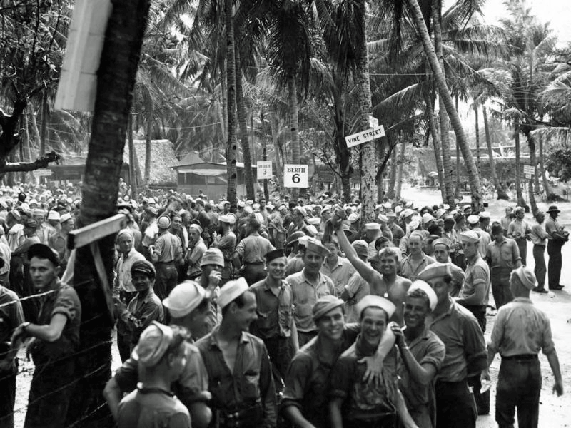
Ulithi: The Navy's Premier R&R Island in the Central Pacific
View the R&R story of Ulithi as told in these historical photos. Slideshow runs automatically, or click on the right arrow in any photo to manually advance to the next slide.
-
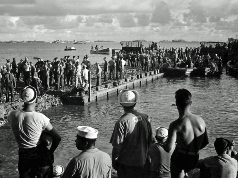
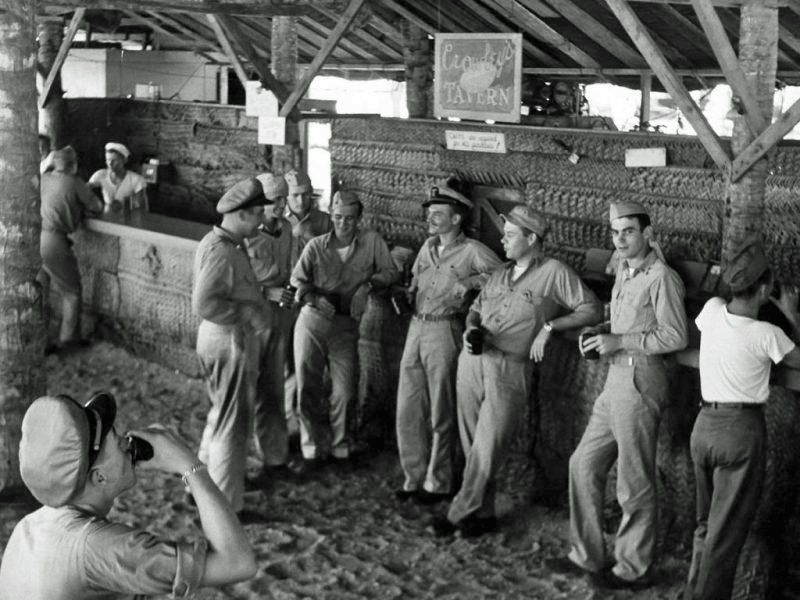
 R&R on Mog-Mog Island in Ulithi Atoll
 -
 Mog-Mog liberty c 1944
 -
 Mog-Mog liberty c 1944
 -
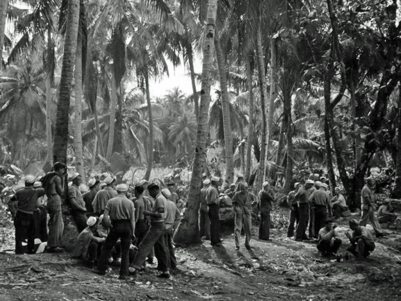 Mog-Mog liberty c 1944
 -
 Mog-Mog liberty c 1944
 -
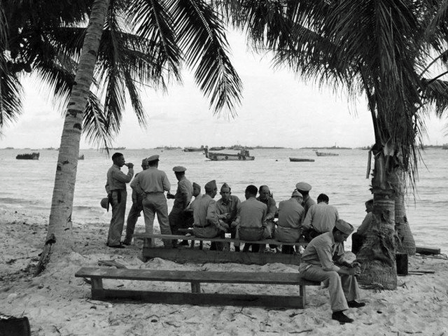 Mog-Mog Officer's Club
 -
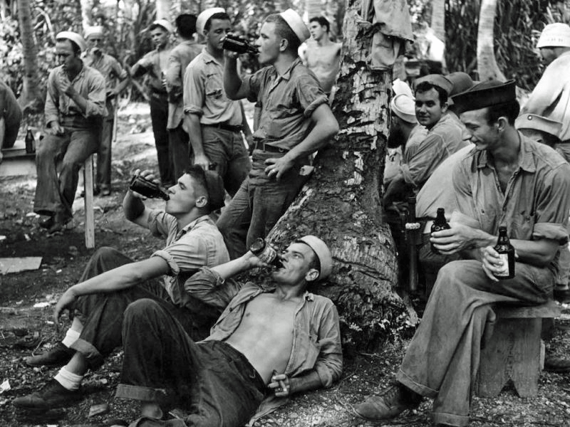
 Mog-Mog liberty
 -
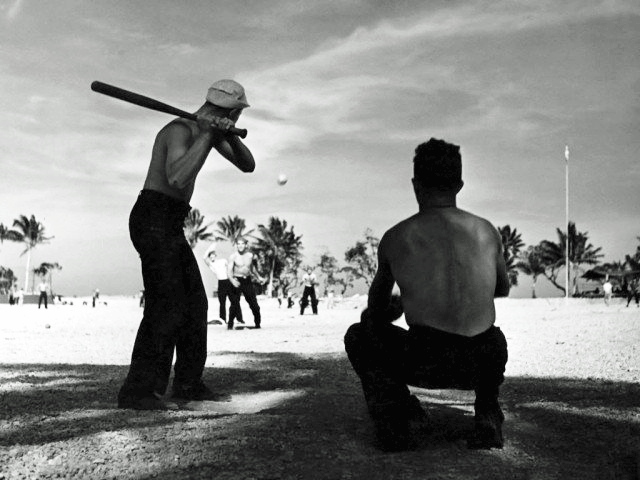 Mog-Mog baseball
 -
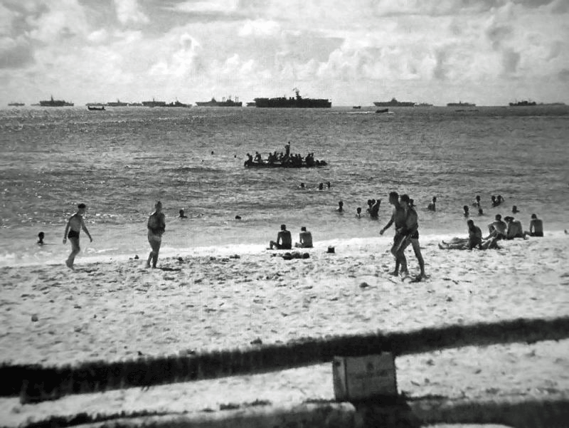 Shipmates from USS Essex (CV-9) enjoy liberty at the beach in Ulithi Atoll December 1944
 -
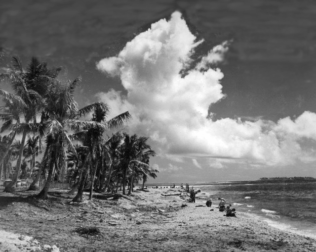
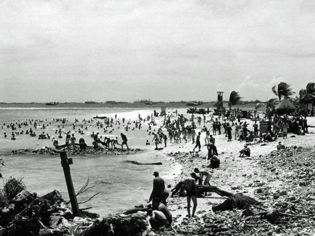 Mog-Mog beach liberty
 -
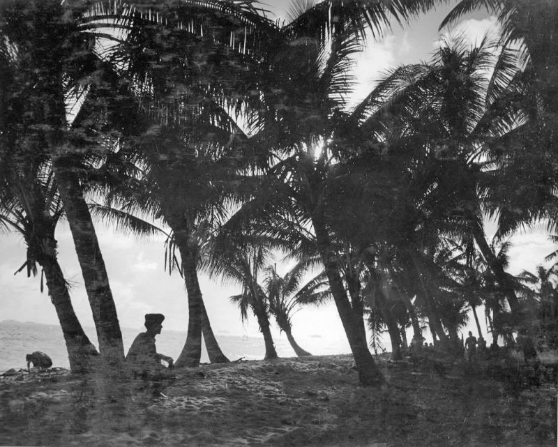 Ulithi R&R among the palms
 -
 Ulithi R&R
 -
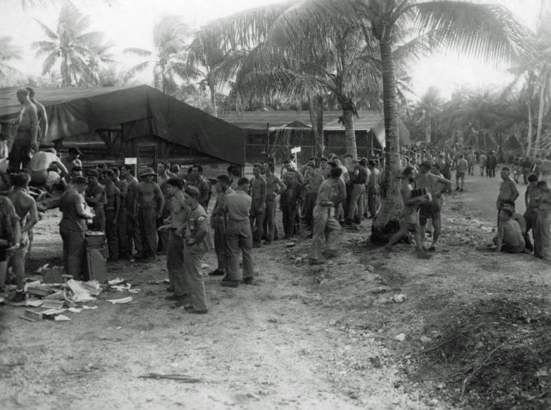 Mail call Ulithi c 1944
 -
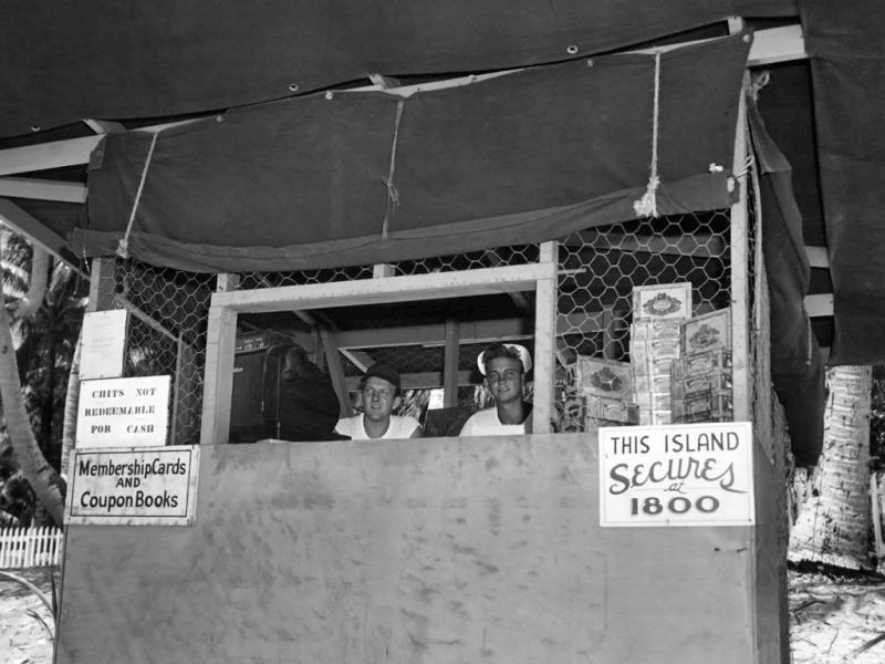 Mog-Mog ticket office
 -
 Mog-Mog liberty in full gear
1945 Military Video
Ulithi Atoll gradually drew down in size as ships moved north but remained in service throughout the end of the war. The video below shows the sheer size of the fleet anchored there. [2 minutes, 11 seconds]
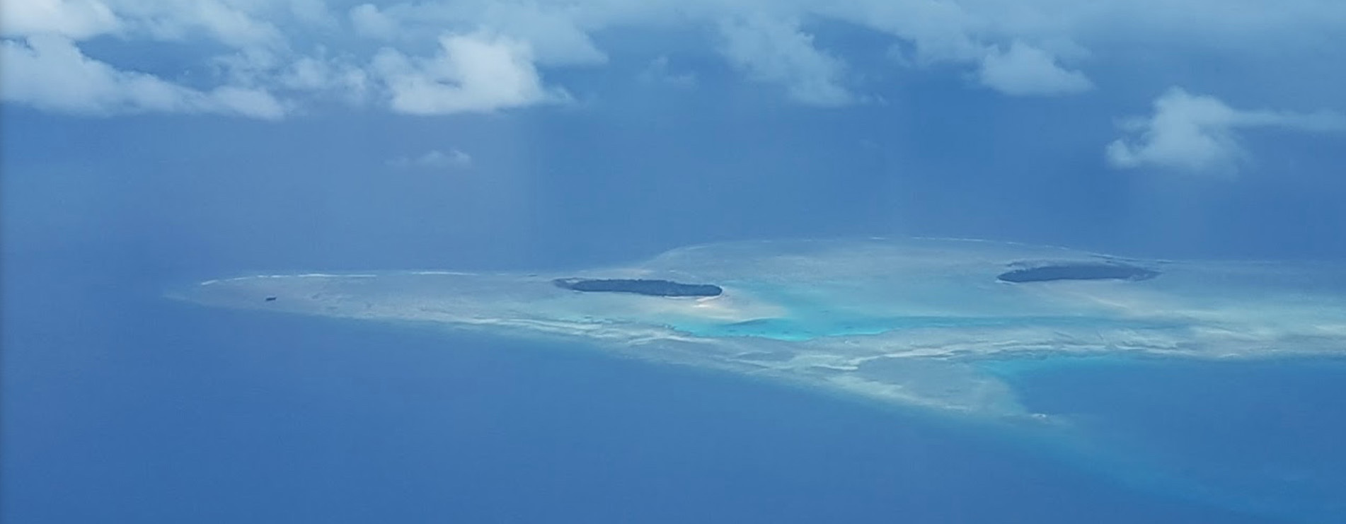
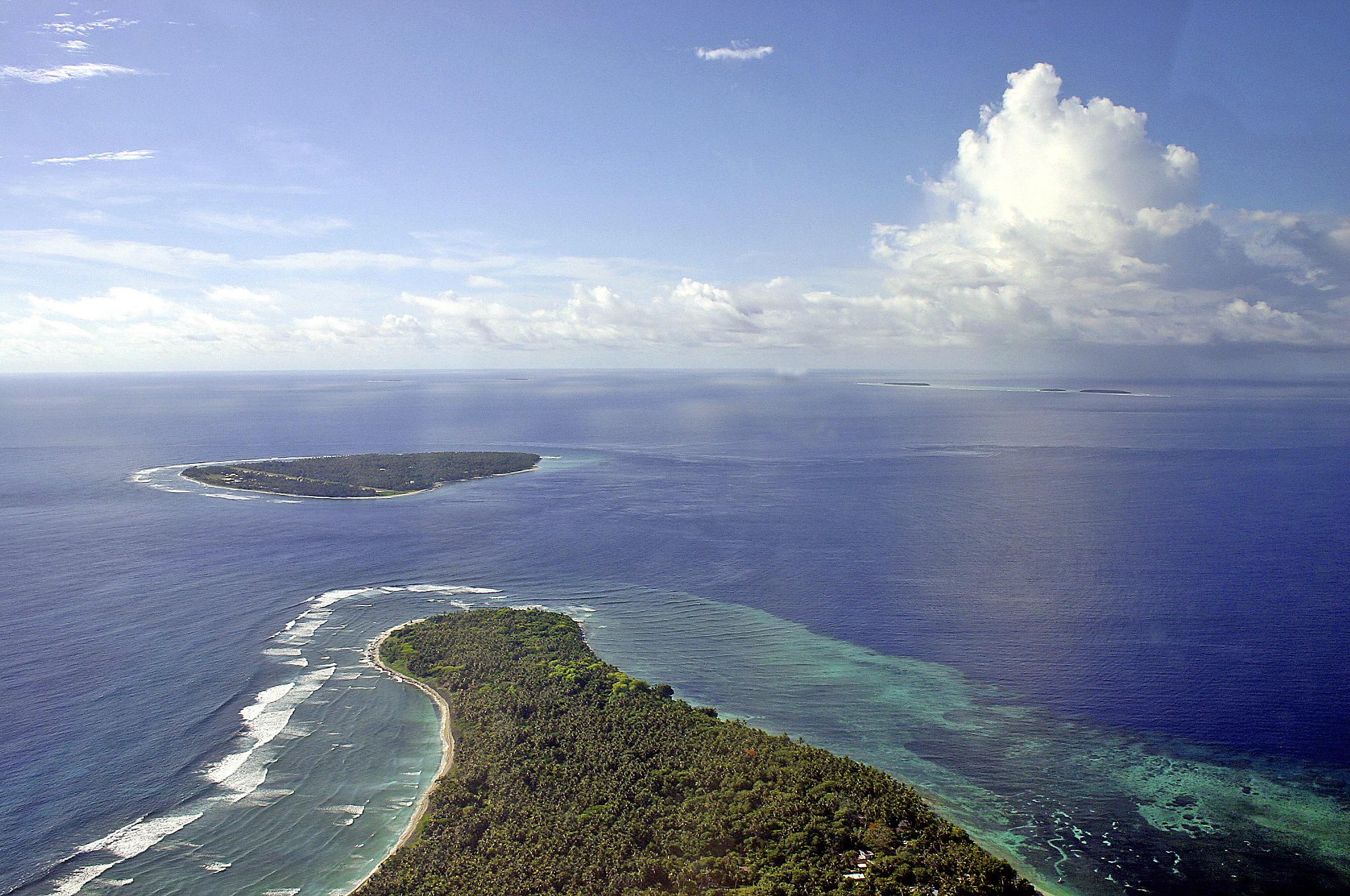
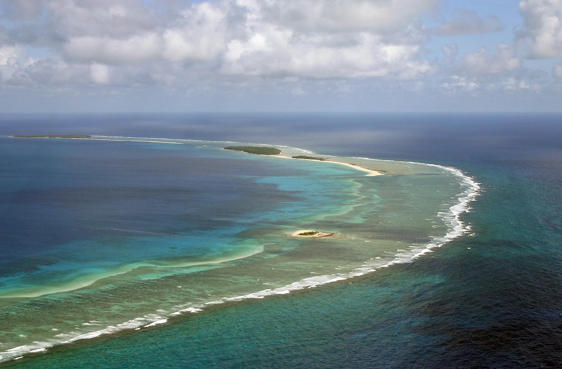
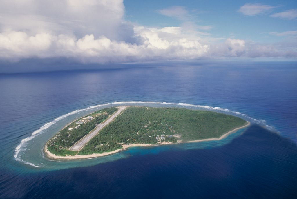
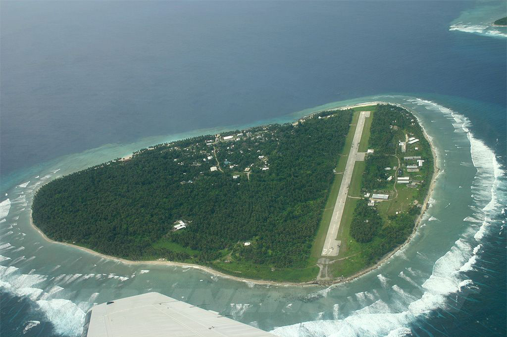
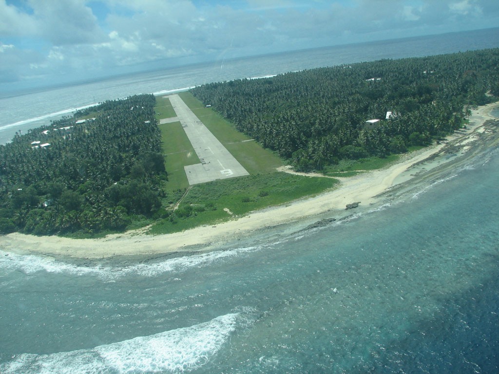
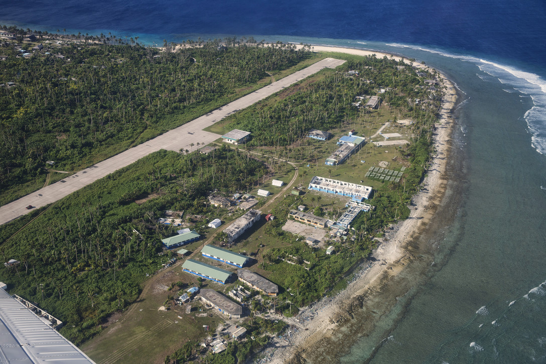
Ulithi Today
Some views of Ulithi today as seen from the air. Slideshow runs automatically, or click on the right arrow in any photo to manually advance to the next slide.
Video of Modern-day Ulithi
Mog Mog island, Ulithi, Micronesia, showcasing life in the remote Pacific. Mog Mog was built up as an American R&R facility as part of the Ulithi naval base during WWII. It is one of the most remote and beautiful islands in the world. Few outsiders have had the chance to see this amazing place. [3 minutes, 49 seconds]
What is an Atoll?
An atoll is a ring-shaped ribbon reef enclosing a lagoon. Atolls begin as an underwater volcanoes called seamounts. Over time and many eruptions, the seamount grows until it rises above the water and becomes an island. Corals grow around the island and, over geologic time, the volcano goes dormant and sinks, but the coral reefs remain and continue to grow faster than the island sinks, eventually creating an island ring made of coral around a central lagoon where the volcano was formerly located. [3 minutes, 56 seconds]
Sources:
Text: The Pacific War, The Strategy, Politics, and Players Who Won the War, by William B. Hopkins. Zenith Press, © 2008
Website: warhistoryonline.com - Top Secret: US Naval Base At Ulithi Was For A Time The World’s Largest Naval Facility, by Jack Knight (Nov. 17, 2017)
Wikipedia: Ulithi